
Khardung La Travel Guide 2026 – Height, How to Reach, Weather & Road Tips
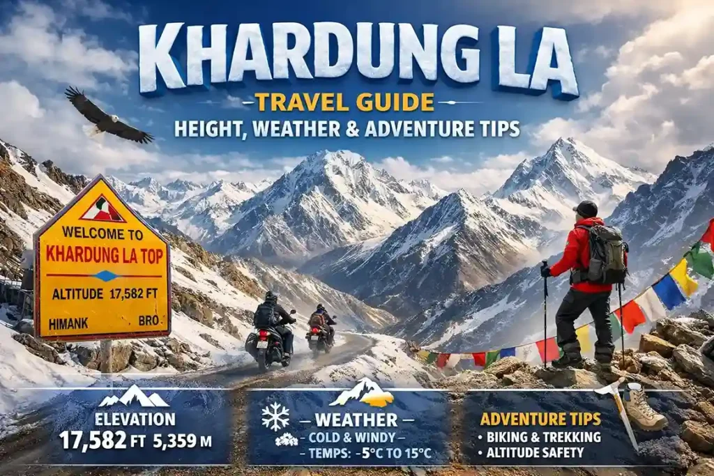
Welcome to the most complete Khardung La travel guide for 2026. Standing at 5,359 metres (17,582 feet) above sea level — confirmed by BRO (Border Roads Organisation) surveys, GPS data, and SRTM satellite mapping — Khardung La Pass is one of the world’s highest motorable roads and the legendary gateway to Nubra Valley in Leh Ladakh.
Located 39 km north of Leh city on the Ladakh Range, Khardung La connects the Indus river valley to the Shyok river valley and serves as the primary supply route for the Indian Army’s Siachen Glacier operations. Built by the BRO in 1976 and opened to the public in 1988, it has since become one of India’s most iconic adventure destinations — drawing bikers, road trip enthusiasts, trekkers, and photographers from across India and the world.
This Khardung La travel guide covers everything: the correct height and altitude facts, month-by-month Khardung La weather, how to reach from Leh, the checkpoint route, permits, the 9 AM–2 PM timing secret, Khardung La bike trip guide, and what to experience at the summit. Whether you are visiting as part of a Leh Ladakh tour package or planning independently, this guide has everything you need.
⛰️ Correct Height: 5,359m / 17,582 ft (BRO + GPS confirmed) — old roadside signs show 18,379 ft which is inaccurate
🔗 Khardung La Connects: Leh / Indus Valley (south) ↔ Nubra Valley / Siachen Glacier (north)
🚗 Leh to Khardung La Distance: 39 km · Taxi: 1.5–2 hrs · Bike: 1–1.5 hrs
📅 Open Season: Mid-May to October · Closed Nov–April (heavy snow)
🕘 Best Time of Day: 9 AM – 2 PM only (clearest skies · safest roads · best photography)
🫁 Oxygen Level: ~50% of sea level — limit time at summit to 20–30 minutes
🎫 Permit (ILP): Required to continue to Nubra Valley — get free online at lahdclehpermit.in
Where is Khardung La Located
Khardung La is situated in the Union Territory of Ladakh, Jammu & Kashmir, India. It lies about 40 km north of Leh and serves as a gateway to Nubra Valley. The pass is surrounded by towering, snow-capped mountains and a stark, arid landscape that changes dramatically as you ascend.
Khardung La Height & Elevation — Correct Facts
The correct height of Khardung La is 5,359 metres (17,582 feet) above sea level. This is confirmed by BRO surveys, hundreds of GPS readings, SRTM satellite data, and Russian topographic mapping.
The figure of 18,379 ft (5,602m) on the famous roadside signboard is inaccurate. It has appeared on the sign for decades and on Leh t-shirts and souvenirs — but no credible survey supports it. The actual altitude of 17,582 ft is still extraordinary and makes Khardung La one of the world’s highest motorable roads.
Is Khardung La the Highest Motorable Road in the World?
No — not anymore. Umling La Pass (5,883m / 19,301 ft) in Ladakh, opened in 2021, holds the title of world’s highest motorable road. Marse La (5,582m) and Semo La (5,565m) also exceed Khardung La. However, Khardung La remains far more famous and accessible than any of these passes — it is the most popular high-altitude road in India.
What Does Khardung La Connect?
Khardung La Pass connects two vital valleys of Ladakh:
- South side — Indus Valley: Leh city, and the main inhabited valley of Ladakh. Home to Leh Palace, Shanti Stupa, Hemis and Thiksey monasteries.
- North side — Shyok Valley / Nubra Valley: The stunning cold desert of Nubra with sand dunes at Hunder, Diskit Monastery, Bactrian camels, and the route to the Siachen Glacier.
Historically, Khardung La was a key caravan route on the ancient Silk Road connecting Leh to Kashgar in Central Asia — thousands of horses and camels crossed it annually. The descendants of those Bactrian camels can still be seen at Hunder in Nubra Valley. Today, Khardung La is the primary Indian Army supply route to the Siachen Glacier — the world’s highest battlefield.
Khardung La Facts Table
| Fact | Detail |
|---|---|
| Correct altitude | 5,359m / 17,582 ft |
| Signboard altitude (inaccurate) | 5,602m / 18,379 ft — not verified by surveys |
| Located in which state | Ladakh (Union Territory) — NOT Himachal Pradesh, NOT J&K |
| Mountain range | Ladakh Range |
| Road built by | BRO (Border Roads Organisation), Project Himank, 1976 |
| Opened to public | 1988 |
| Connects | Leh (Indus Valley) ↔ Nubra Valley / Siachen (Shyok Valley) |
| Oxygen level at summit | ~50% of sea level — limit time at top to 20–30 minutes |
How to Reach Khardung La — Leh to Khardung La Route Guide
Khardung La is accessible only by road. Fly or take a train to Leh (IXL airport) first, then drive or ride to the pass. The nearest airport is Kushok Bakula Rimpochee Airport, Leh — 40 km south of the pass.
Distance Table — Khardung La from Major Points
| Route | Distance | Travel Details |
|---|---|---|
| Leh to Khardung La | 39 km | Taxi: 1.5–2 hrs · Bike: 1–1.5 hrs |
| Delhi to Khardung La | ~1,000 km | Fly Delhi–Leh (1.5 hrs) + drive to pass |
| Manali to Khardung La | ~514 km | 2-day road trip via Manali–Leh Highway |
| Khardung La to Nubra Valley | 100 km | 3–3.5 hrs descent via North Pullu |
| Khardung La to Siachen Glacier | ~150 km+ | Military route — restricted for civilians |
Checkpoint-by-Checkpoint Route: Leh to Khardung La
- Leh (0 km, 3,505m): Depart by 7–8 AM. Fill fuel tank completely. Carry water, snacks, warm clothes.
- South Pullu Checkpoint (15 km, ~3,700m): First army checkpoint. ILP permit checked here for Nubra Valley access. Road is smooth and paved Leh to South Pullu.
- Rough Ascent (15–39 km): Road narrows with hairpin bends, steep gradients, and rough patches. 4×4 or good clearance recommended. Bikers: go slow on loose gravel sections.
- Khardung La Summit (39 km, 5,359m): Yellow BRO signboard, cafeteria, Gompa temple, prayer flags. Spend 20–30 minutes maximum.
- North Pullu Checkpoint (44 km): Second army checkpoint on descent toward Nubra. Permit checked again.
Travel Options from Leh to Khardung La
| Mode | Time | Cost | Notes |
|---|---|---|---|
| Private taxi (4×4) | 1.5–2 hrs | ₹2,500–₹4,000 return | Safest option ✅ Recommended for first-timers |
| Shared taxi | 1.5–2 hrs | ₹500–₹800/person | From Leh taxi stand. Departs when full. |
| Bike (Royal Enfield) | 1–1.5 hrs | ₹900–₁,500/day rental | Most iconic experience. Mountain experience required. |
| JKSRTC Bus | 2–3 hrs | ₹200–₹300 | Seasonal Leh–Nubra bus passes through Khardung La. |
Khardung La Weather & Temperature — Month by Month
Understanding Khardung La weather is essential before planning your visit. At 5,359m altitude, conditions change rapidly — even sunny mornings can turn overcast and windy by afternoon.
| Month | Temperature | Road Status | Conditions |
|---|---|---|---|
| Jan–Feb | -20°C to -30°C | Closed / dangerous | Extreme snowfall. Do not attempt. |
| Mar–Apr | -15°C to 0°C | BRO clearing snow | Road being cleared. Not for tourists. |
| May | -5°C to 10°C | Opens mid-May | Snow at summit, beautiful, fewer crowds. |
| June | 2°C to 15°C | Open ✅ | Good conditions. Peak season beginning. |
| Jul–Aug | 5°C to 15°C | Open ✅ Peak season | Most popular. Occasional afternoon slush. Crowded at top. |
| September | 0°C to 12°C | Open ✅ Best month | Crystal clear skies, fewer tourists, snow-capped peaks. Highly recommended. |
| October | -5°C to 8°C | Check daily — closing | Early snowfall likely. Check road status before going. |
| Nov–Apr | -15°C to -30°C | Mostly closed | Extreme cold. Army vehicles only. |
Best time to visit Khardung La: June–September overall. September is the hidden gem — clear skies, empty roads, snow-capped peaks, and crisp air.
Khardung La Bike Trip — Complete Guide for Riders
The Khardung La bike trip from Leh is one of India’s most iconic rides. Thousands of bikers make this journey every summer — many as part of the legendary Manali–Leh–Khardung La–Nubra Grand Circuit.
Best Bikes for Khardung La (Leh Rentals)
- Royal Enfield Himalayan 411: ₹1,200–₁,500/day — purpose-built for mountain terrain, best choice for Khardung La
- Royal Enfield Classic 350/500: ₹900–₹1,200/day — widely available, well-suited to the road
- KTM Duke 390: ₹1,000–₁,400/day — lighter, responsive, good for experienced riders
- Scooter / Activa: ❌ Not recommended — insufficient power and ground clearance for the rough section above South Pullu
Rental shops are concentrated on Fort Road and Main Bazaar, Leh. Inspect the bike carefully before departing — tyres, brakes, chain, fuel, tool kit.
Bike Ride Tips — Safety First
- Acclimatise 2 nights in Leh first: Altitude affects reaction time and breathing. Riding to 5,359m on arrival day is dangerous.
- Depart Leh 7–8 AM, reach summit 9–10 AM: Before afternoon clouds, wind, and military convoy traffic.
- Full tank before leaving: Zero petrol pumps between Leh and the summit.
- Full riding gear: Windproof jacket, gloves, balaclava, thermal layer. Summit can be 0–5°C with wind chill even in July.
- Dust mask essential: Military trucks generate heavy dust continuously on the Khardung La road.
- Never ride in rain or wet road: The dirt section above South Pullu becomes dangerously slippery when wet.
- Royal Enfield Khardung La jacket: The iconic souvenir sold at the summit cafeteria — proof you made it to 17,582 ft.
The Journey to Khardung La
Traveling to Khardung La is an adventure in itself. As you drive past towering mountains and barren landscapes, the thrill increases with every kilometer. Checkpoints along the way verify permits and ensure safety. At higher altitudes, you may experience shortness of breath, so acclimatization is crucial.
Top Experiences at Khardung La Pass
1. The Iconic BRO Signboard
The yellow BRO signboard at the summit is India’s most photographed adventure landmark. Standing at the sign with Himalayan peaks stretching in every direction and prayer flags whipping in the mountain wind is an exhilarating, earned moment. Best photo time: 9–11 AM when light is clearest and the signboard area is less crowded.
2. Cafeteria at the Top
The Khardung La cafeteria serves Pahado Wali Chai and Maggi noodles — two of the most celebrated snacks in Indian adventure culture. Having a hot tea at 5,359m while the Himalayan range stretches to the horizon is one of those simple experiences that feels extraordinary. The cafeteria also sells the famous Royal Enfield Khardung La jacket — an iconic souvenir for bikers.
3. Khardung La Gompa
A small Buddhist Gompa (temple) sits at the summit alongside hundreds of colourful Tibetan prayer flags (Lung-ta). Many travelers and bikers stop here to seek blessings. The Gompa is one of the highest places of Buddhist worship in the world and is particularly atmospheric in the early morning light.
4. Photography
Snow-covered peaks, prayer flags against deep blue sky, the winding road disappearing into the Himalayan landscape, and the stark barren terrain of the Ladakh Range — Khardung La is exceptional for photography. Best light: 9–11 AM. Cold drains batteries rapidly — carry a full power bank.
5. Camping Under the Stars
Designated camping spots near Khardung La — including Buddha Point — offer extraordinary stargazing. At 5,000m+ altitude with zero light pollution, the Milky Way is clearly visible to the naked eye. Night temperatures can drop below -10°C even in summer — proper cold-weather gear essential. Limit to one night.
6. Continue to Nubra Valley
Most visitors who cross Khardung La continue north to Nubra Valley — the descent from the stark lunar landscape of the pass into the green river valleys, sand dunes, and Bactrian camel herds of Hunder is one of the most dramatic landscape transitions in India. Distance: Khardung La to Diskit (Nubra’s main town) = 100 km, approximately 3 hours.
Khardung La Travel Tips — Complete Safety Guide
- Acclimatise in Leh for minimum 2 nights first: Going directly to Khardung La (5,359m) on Day 1 in Leh (3,505m) is dangerous. Spend 2 full days in Leh doing gentle sightseeing to prepare your body for altitude.
- Visit 9 AM – 2 PM only: Best visibility, safest roads, best photography light. Depart Leh by 7–8 AM.
- Carry oxygen and a pulse oximeter: Oxygen at 5,359m is ~50% of sea level. Many Leh hotels provide portable oxygen. A pulse oximeter monitors your SpO2 — below 80% = rest immediately, below 70% = descend.
- Fill fuel completely in Leh: No petrol pumps on the route. Running out of fuel at altitude is dangerous.
- ILP permit for Nubra Valley: Required to cross Khardung La and continue to Nubra. Apply free online at lahdclehpermit.in before departing Leh.
- Pack warm layers for summer visits: Summit temperature in July can be 5°C with strong wind. A windproof jacket and gloves are essential regardless of season.
- Apply SPF 50+ sunscreen and wear UV sunglasses: UV radiation at 5,000m is significantly stronger than at sea level. Snow and white rock surfaces reflect UV back — sunburn and snow blindness are real risks.
- Wear a dust mask: Military trucks use this road constantly. Dust levels are extreme, especially on the section approaching the summit.
- Limit summit time to 20–30 minutes: Hypoxia — dizziness, nausea, confusion — can develop quickly at 5,359m if you stay too long. Enjoy the view and descend.
- Check road status before departing: The road can be closed temporarily due to snowfall, avalanche clearing, or military convoy movements. Always confirm with your hotel or check Leh administration updates.
Khardung La Permit — Do You Need One? (2026)
Visiting Khardung La Summit Only (Day trip from Leh)
You do NOT need an ILP to simply drive to the Khardung La summit and return to Leh. No permit is required for the pass itself.
Continuing Beyond Khardung La to Nubra Valley
An Inner Line Permit (ILP) is mandatory to cross into Nubra Valley. Army checkpoints at South Pullu and North Pullu will check your permit. Without it, you will be turned back.
- How to get: Apply online at lahdclehpermit.in — instant QR code on phone, no printing needed. Or get it from DC Office, Leh (Main Market, 9 AM–3 PM).
- Fee: Green Fee ₹400 + Red Cross Fund ₹100 + Wildlife Fee ₹20/day — paid with ILP application.
- Document needed: Aadhaar card or any government photo ID (Indians). Passport + Indian visa (foreigners).
- Foreigners: Need Protected Area Permit (PAP) from DC Office. Must travel in minimum group of 2.
Visit Khardung La with Content Holidays
Khardung La is included in all our Leh Ladakh packages. Our local drivers know the Khardung La road personally and plan your visit for the optimal 9 AM–2 PM window every time.
Short Trip
Magical Ladakh 6D 5N
Leh · Khardung La · Nubra Valley · Pangong Lake
₹18,000 /person
View Package →Most Popular
Breathtaking Leh 9D 8N
Leh · Khardung La · Nubra · Pangong · Tso Moriri
₹28,000 /person
View Package →Ultimate
Kashmir + Ladakh 12D 11N
Srinagar · Gulmarg · Leh · Khardung La · Nubra · Pangong
₹38,000 /person
View Package →Custom
Custom Leh Ladakh Package
Any duration · Any destinations · Group discounts
From ₹15,000 /person
Get Custom Quote →Why Choose Content Holidays
Planning your trip with Content Holidays ensures:
- Customized travel packages
- Comfortable transportation
- Verified accommodations
- Local expertise
Visit 👉 https://contentholidays.com/ to plan your dream Khardung La.
Frequently Asked Questions
Q: What is the height of Khardung La?
A (CORRECTED): The correct height of Khardung La is 5,359 metres (17,582 feet) above sea level, confirmed by BRO surveys and GPS data. The famous roadside signboard shows 18,379 ft (5,602m) — this figure is inaccurate and not supported by any official survey. The actual altitude is still extraordinary and makes Khardung La one of the world’s highest motorable roads.
Q: What does Khardung La Pass connect?
A: Khardung La Pass connects Leh city and the Indus River valley (south) to Nubra Valley and the Shyok River valley (north). It was historically a Silk Road caravan route from Leh to Kashgar in Central Asia. Today it is the Indian Army’s primary supply route to the Siachen Glacier and the main road for tourists travelling from Leh to Nubra Valley.
Q: Khardung La Pass is located in which state?
A: Khardung La Pass is located in the Leh district of Ladakh — a Union Territory of India since October 2019. It is NOT in Himachal Pradesh or Jammu & Kashmir. Ladakh became a separate Union Territory when J&K was bifurcated, and Khardung La falls within the Leh district of this UT.
Q: What is the oxygen level at Khardung La?
A: Oxygen levels at Khardung La (5,359m) are approximately 50% of sea level — every breath provides roughly half the oxygen you would get at normal altitude. This is why acclimatisation in Leh for 2 nights before visiting is essential. Limit your time at the summit to 20–30 minutes, carry a pulse oximeter, and descend immediately if you feel severe breathlessness, confusion, or dizziness.
Q: When does the Khardung La road open and close?
A: The Khardung La road typically opens in mid-May when BRO completes snow clearance and remains open through October. The exact dates vary each year based on snowfall. The road can be temporarily closed during the open season due to snowfall, avalanche clearing, or military convoy movements. Always check current road status with your hotel or via the Leh administration website before planning your visit.
Plan Your Khardung La Trip with Content Holidays
Content Holidays operates all Leh Ladakh packages directly from Srinagar. Our drivers have made the Khardung La road hundreds of times and plan every visit for the optimal morning window. When you travel with us, your Khardung La experience is handled by people who know this road personally — not a travel aggregator in Delhi or Mumbai.
Call or WhatsApp — plan your Khardung La & Leh Ladakh trip
+91 7006684126
Available 10 AM – 7 PM daily · WhatsApp response within 30 minutes
Get a Free Quote →Also explore: Leh Ladakh Travel Guide · All Leh Ladakh Packages · Kashmir Tour Packages
Anzer Ahmad is a Kashmir-based travel expert and founder of Content Holidays, specializing in customized Kashmir and Leh Ladakh tour packages. With years of on-ground experience helping thousands of travelers explore the valleys of Gulmarg, Pahalgam, and Dal Lake, Ahmad brings firsthand knowledge and trusted guidance to every journey